A few years ago we had talked about planning a trip to Utah, but to make a long story short, life happened and we never made it out here. We have several trail friends in various parts of the state, so this drive south seemed like the perfect time to finally visit. Due to our late season timing we weren’t able to visit everyone, but we’ve barely scratched the surface of things to see and do here and are already planning to come back in warmer weather.
Our first stop was Moab to visit a trail friend we hadn’t seen for over a year. She was in a group of hikers we met in Glacier within our first few days on the CDT and ended up hiking with for almost all of Montana.
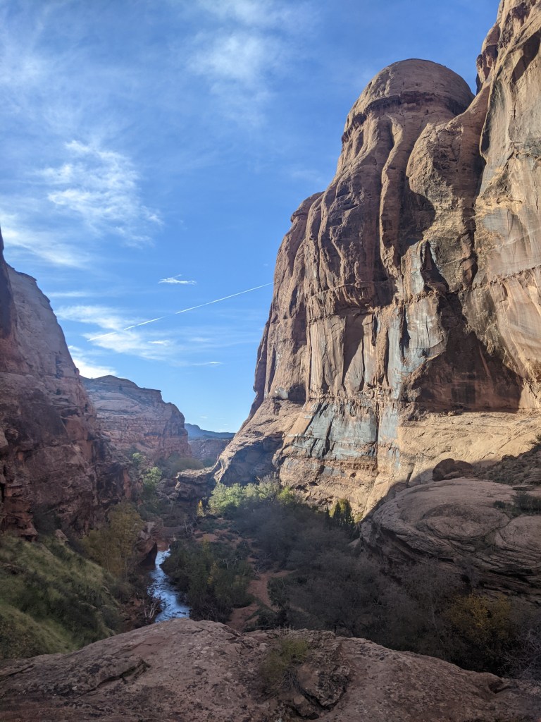
We spent an afternoon hiking into a canyon not far out of town. Much of the trail was fairly washed out from a recent storm, but fortunately our friend had hiked it enough that she knew where to go.
The picture to the left is the view from where we ended up turning around.
Arches National Park is a convenient four miles outside of Moab, so after waiting a day to avoid the weekend rush, that was our next stop. Matt had already visited the park when he was a kid, but it was my first time there. Our intention was to go in with our usual national park game plan of getting there early and driving straight to the longest/coolest hike to beat the crowds. Arches wasn’t nearly as busy as we were worried it might be though, so we ended up stopping at a lot more than we’d initially planned.

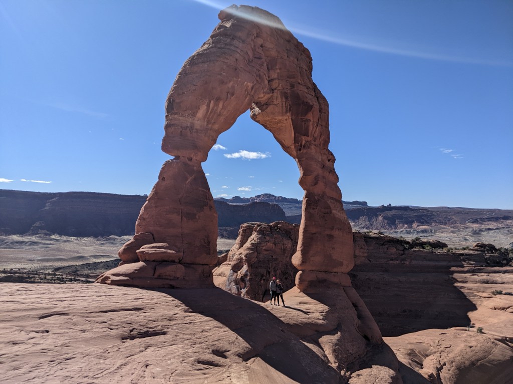
One of the more popular arches is Delicate Arch. This one is accessible by a 1.5 mile steady uphill climb, or it can be viewed from two other trails a short distance away. We opted for the route that would bring us to see it up close. Despite this being one of the most popular hikes in the park, it was surprisingly quiet at the top.
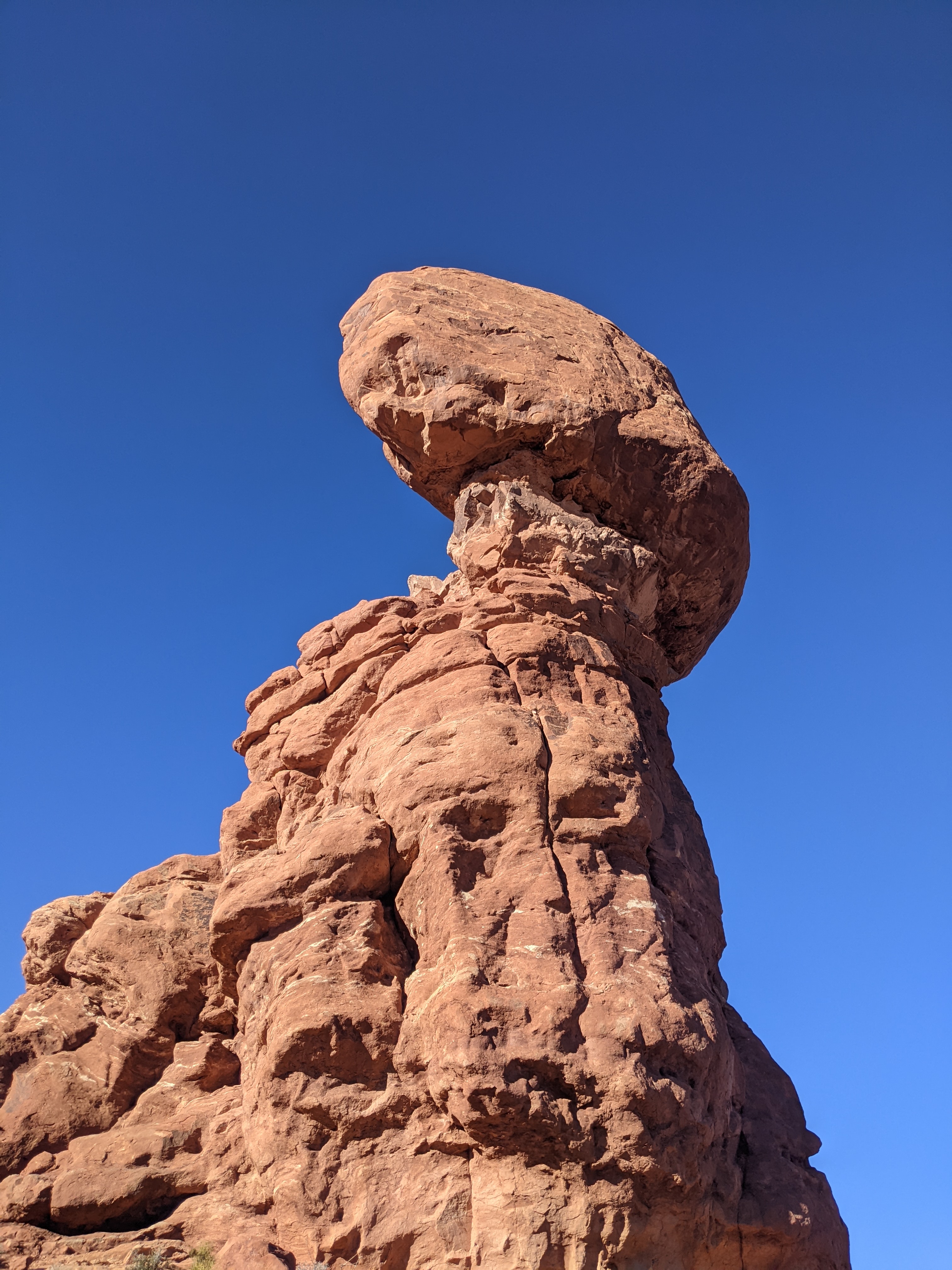
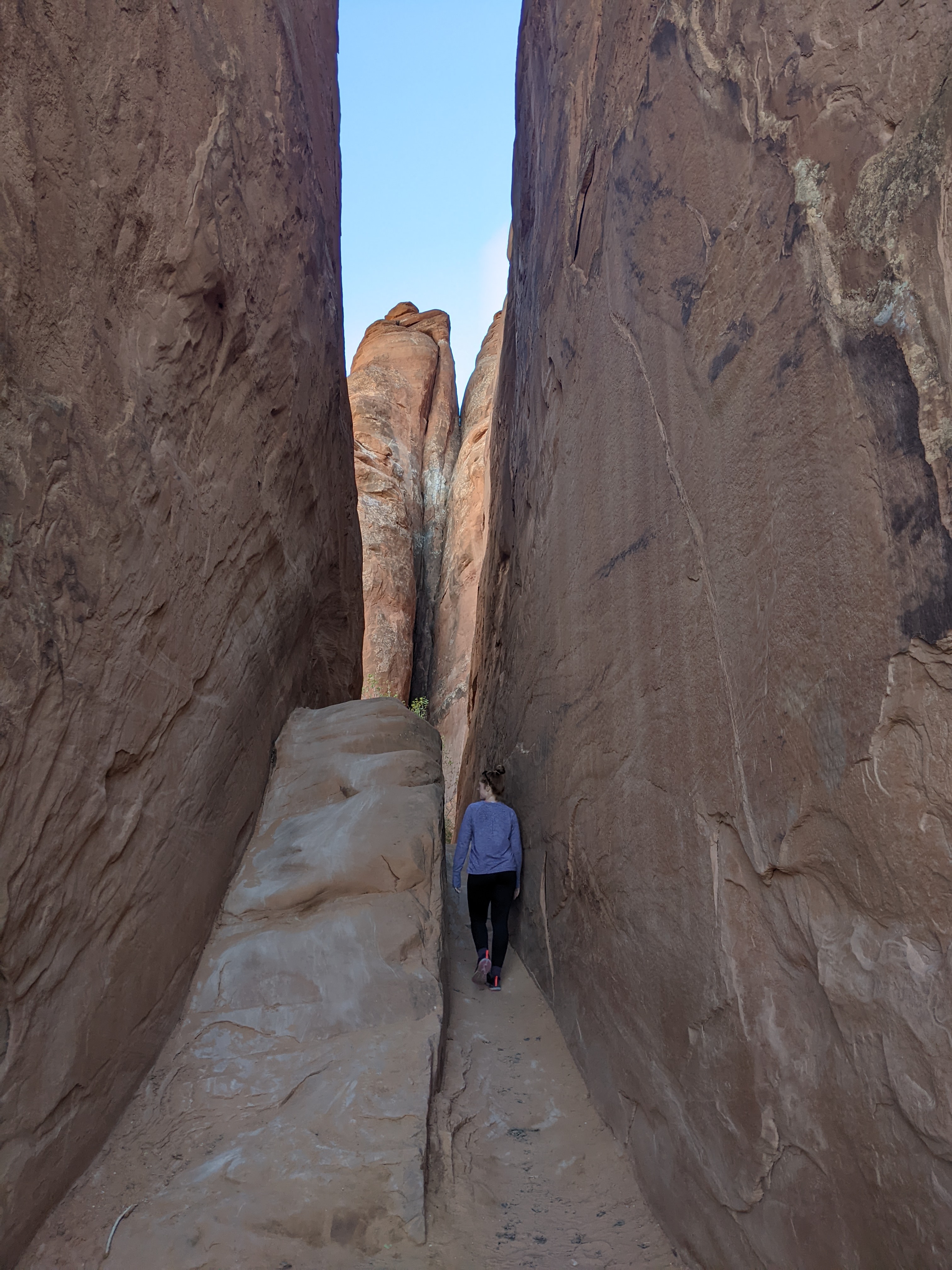
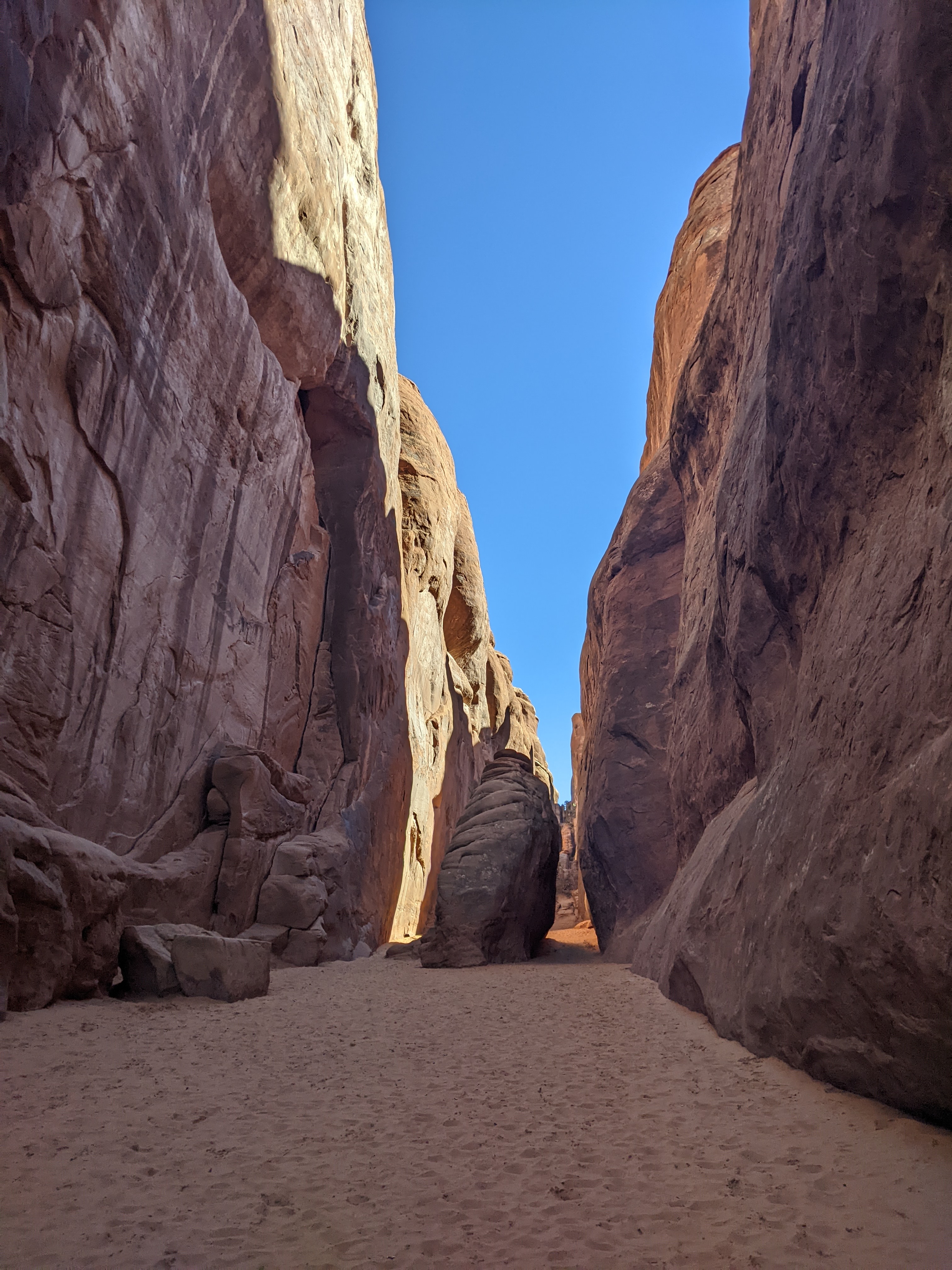
Aside from a quick bop up to Delicate Arch, our main goal for our park visit was to get to the Devil’s Garden trail at the very end of it. Quite a few of the stops we made along the way were decided simply by seeing empty parking spaces and thinking, why not? The series of photos below was one such stop.

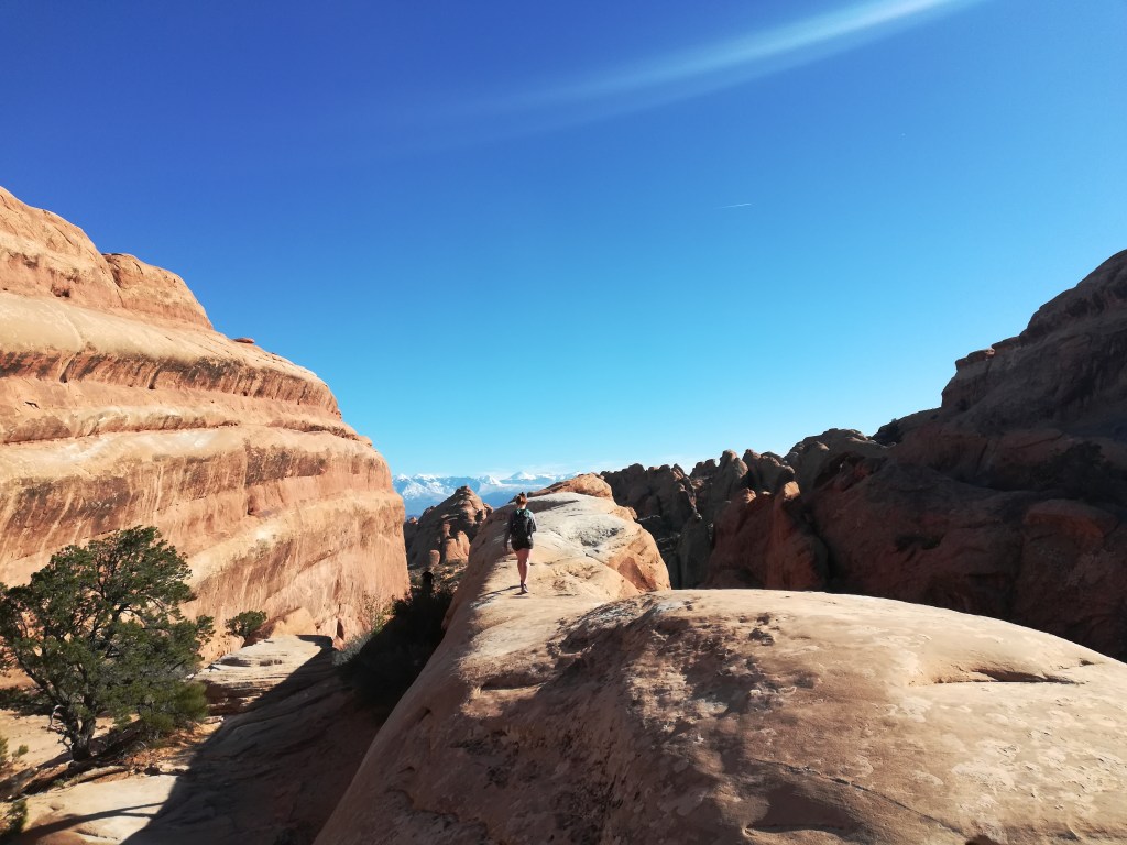
Eventually we made our way to the end of the park road and one of the bigger trailheads. There are a few options from that one spot, with several arches on each one. We accidentally missed a few that we wanted to see, but we did get to hike the Devil’s Garden trail, a minimally marked eight mile loop with enough scrambling and narrow ledges to keep your heart rate up.
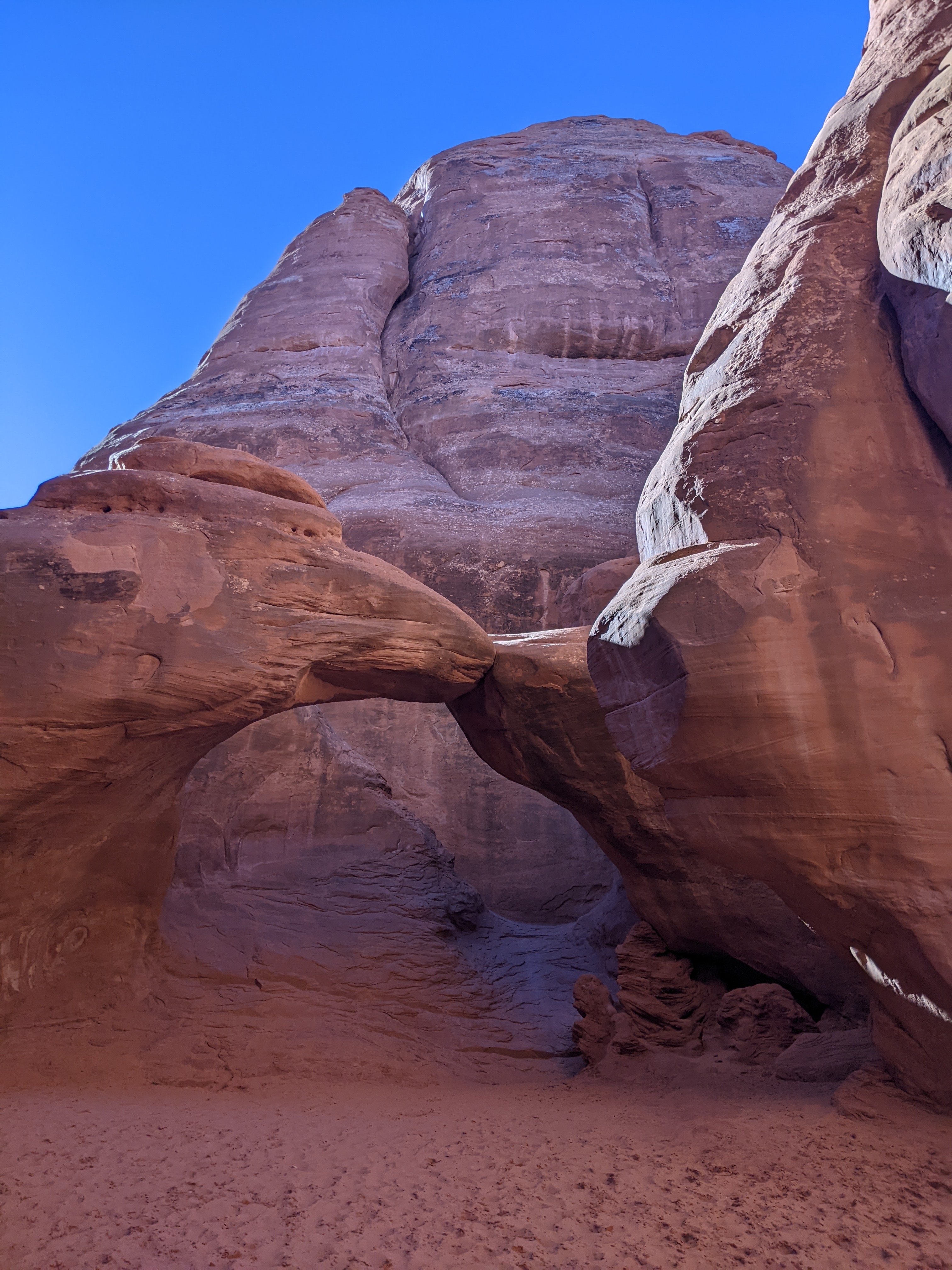
The photo to the left is the Double O Arch, one of the features accessible from the Devil’s Garden Trail. If you look closely, you can see the lower arch behind the plant near the base.
In the photo below, you can see the view from the top of the first climb on that trail.