Hello again! Whew, it’s been a while, I know. Somewhere back around Southern Colorado / Northern New Mexico I finally accepted that posting as regularly as I wanted to just wasn’t going to happen for a number of reasons. A lot has happened since our last post on the Great Divide Basin, for starters we’ve hiked through two more states and completed the entire trail. We’re going to keep posting about the rest of it in chronological order though, to give you the best picture of our trek across the country.
Shortly after exiting the vast desert of the basin, we found ourselves back in a pine forest and crossing the Wyoming / Colorado state line. Since we had taken an alternate to avoid fire closures back in Montana, this was our first state line crossing marked in any way.
Colorado didn’t waste any time in giving us good elevation. Some of the early climbs were long, some were steep, many were both; all of them were just a taste of what lay in store for us through the rest of the state. The thing about climbs out here is there’s almost always a good view on the way up, we don’t get that as often back east. Not to mention the eastern states, the northeast in particular, don’t really do switchbacks. So compared to what we both grew up hiking, these climbs are still physically challenging, but mentally they’re so much easier.
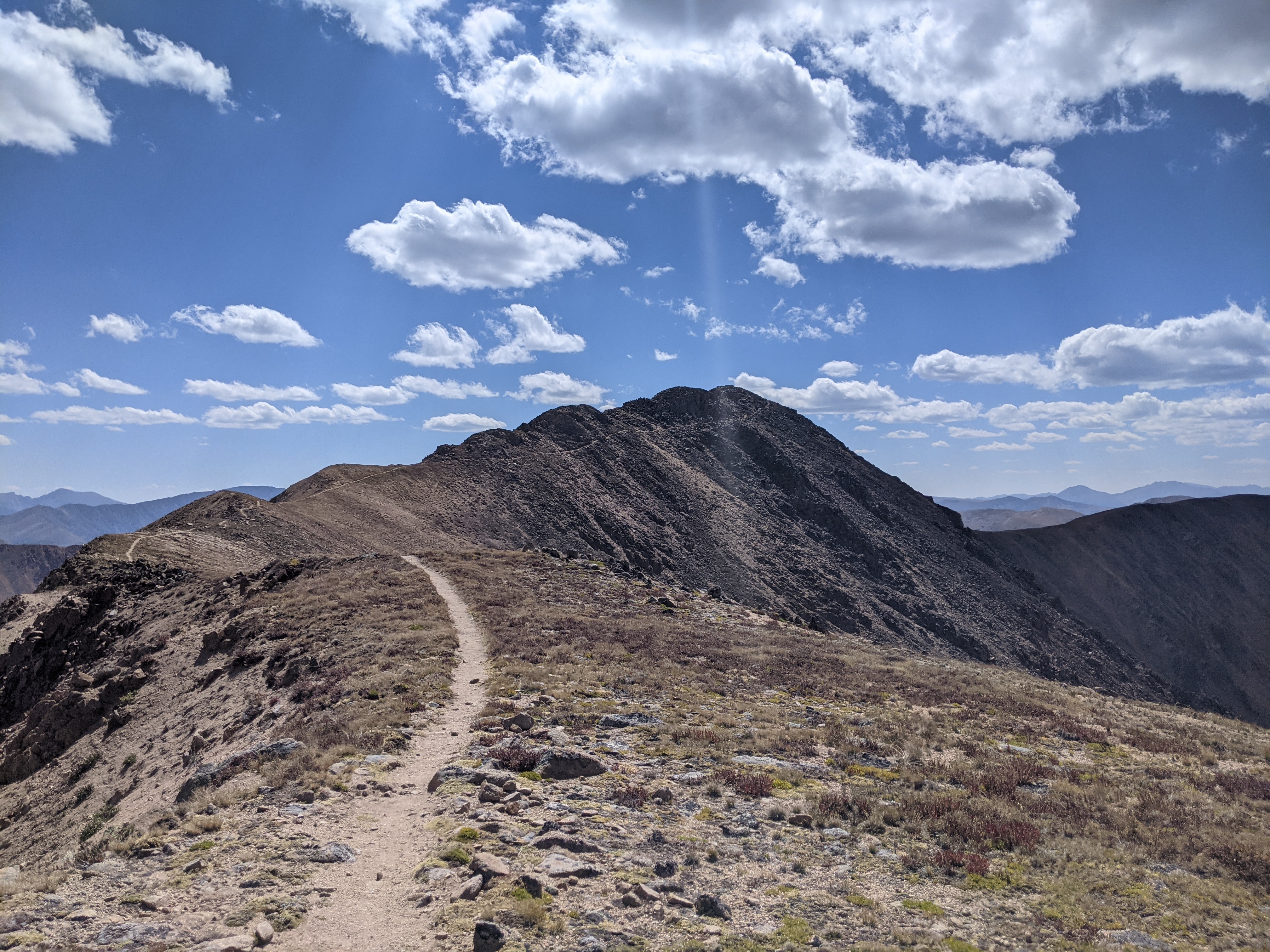
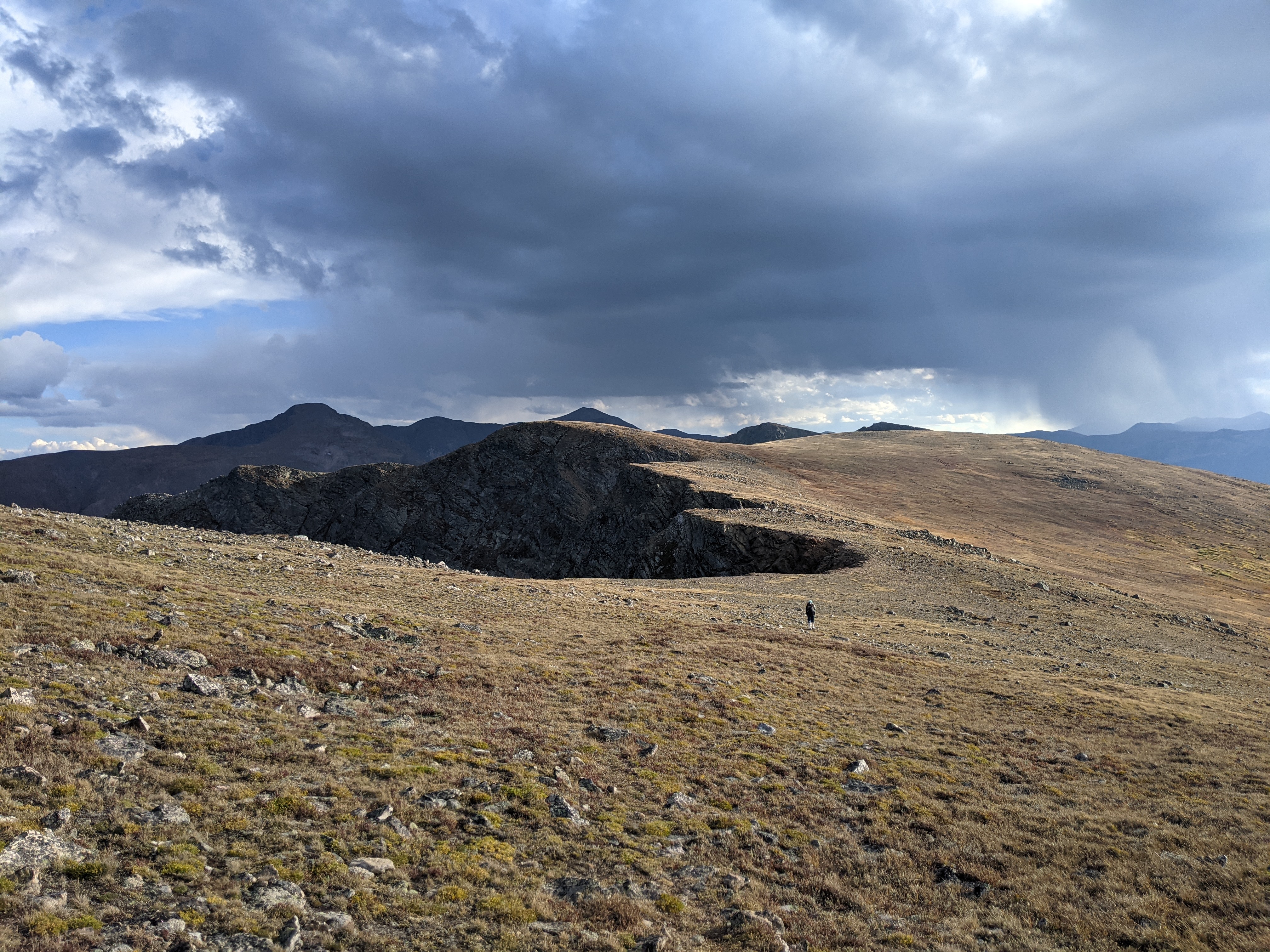
One of our first real Colorado climbs was up to our highest point so far on trail. There were many points along the entire CDT where the trail was not immediately clear for southbound hikers; this climb was one of those points. The picture below on the left was one of the few stretches on this uphill where there was a path to follow. At the summit there was a small hut, covered in the signatures of countless hikers over the years. From there the trail followed the rocky ridge for a while before dropping back down into the trees.


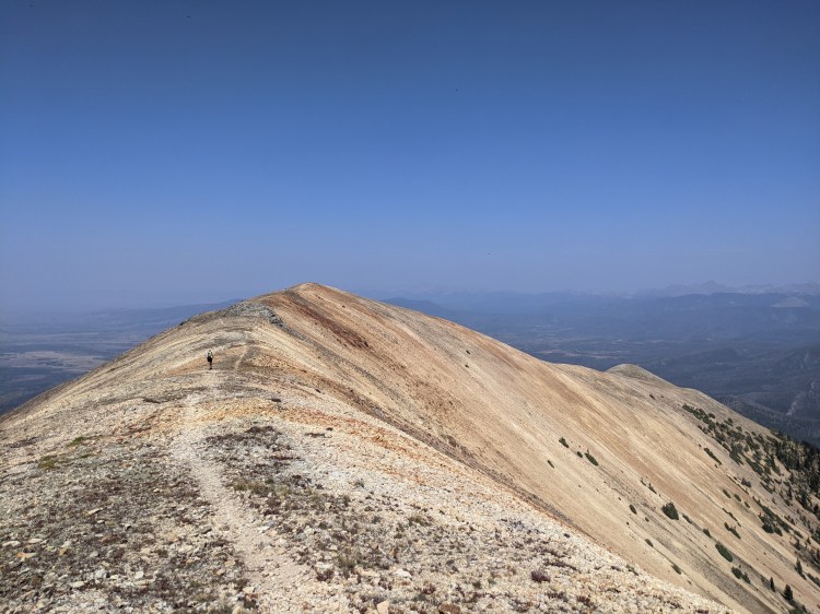
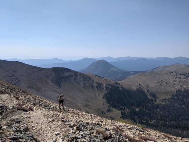
And so the trail continued in that fashion for a few hundred miles: a lot of ridges and valleys with a few peaks and passes thrown in along the way. In the picture below, that ridge in the background is what we followed all the way up to the hut, starting from the base of the prominent peak in the center of the picture. The slight saddle above and slightly to the left of Matt is probably about where I was standing when I took the top left picture above, looking up towards the peak.
An early highlight of the Colorado part of the CDT is where the trail passes through Rocky Mountain National Park. This stretch had been closed for quite a while and we weren’t sure we’d get to go through it, but several days before we reached the park we heard from another hiker ahead of us that the park was once again issuing permits to thru hikers. Taking the opportunity to go through the park slowed us down a bit.
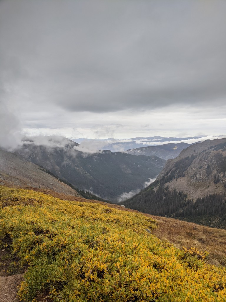
The CDT route was only open to overnight backpackers, so even though the distance would have been manageable for us to do in a single day, we had to settle for two short days with one night in the park. We also could not convince the park ranger who issued our permit that we could in fact make it up and over the ridge on our first day, so they put us at a campsite just below the final climb. As a result we hiked a mere 8-10 miles our first day, leaving us to hike the highest stretch the following day in freezing rain.
We didn’t quite get the views we’d been looking forward to, but our second day in the park still turned out to be fairly satisfying type 2 fun. Despite the many miles through burn areas and the inclement weather, we were glad we made the decision to slow down and take the route through the park. These 20-something miles with this climb would have felt a lot harder without a few months of hiking already behind us.

Prior to heading into Rocky Mountain NP we’d spent a night in Grand Lake, tenting behind a church that allowed free camping for thru hikers. We spent another night there after the park loop, largely to do laundry and let our gear dry out, then the following day we were finally off again at a more normal pace. From Grand Lake the trail stayed low for a while, the only climbs being relatively gradual and quick enough to make good time.

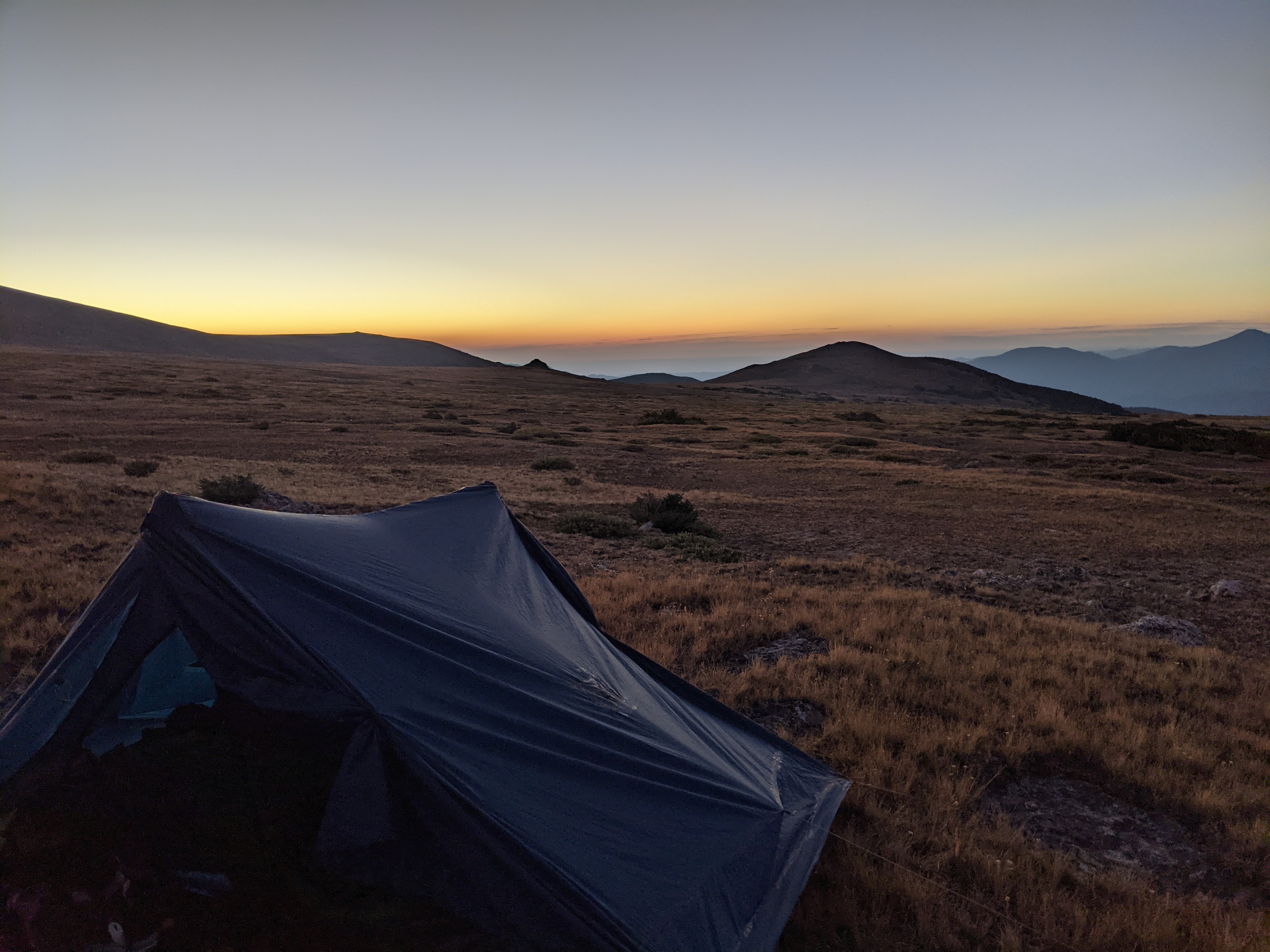
Eventually we found ourselves regaining all of the elevation we’d lost and then some, hiking a rather quick climb up to a ridge, where we were met with the edge of a storm we hiked alongside for the rest of the day. We threw on our rain gear and kept a nervous eye on the sky around us as we pushed ahead to James Peak. Luck was on our side, and while we did get a strong headwind and an occasional shower, the worst of the storm went around us and the skies cleared up for our final summit at sunset.
The next day we dropped down only to immediately start climbing again up to Mt Flora. There was an alternative route we could have taken along a ridge and over several more peaks instead, but we opted to follow the official route to hit the next known water source. We had a fair bit of elevation gain and loss this day, even with half the CDT behind us our legs were still feeling this by the end of the day.

After a chilly night tucked in among a few trees beside the trail, trying for any windbreak we could find, we began our climb back up to the ridge, which we’d follow for most of our day. It was windy, cold, and generally the type of day that makes you extra thankful for a hot shower at the end of it. Fortunately, that’s exactly what we were able to look forward to. One of Matt’s friends was meeting us at a pass about half a days hike from where we’d camped and bringing us back to his house in Denver for a few days.
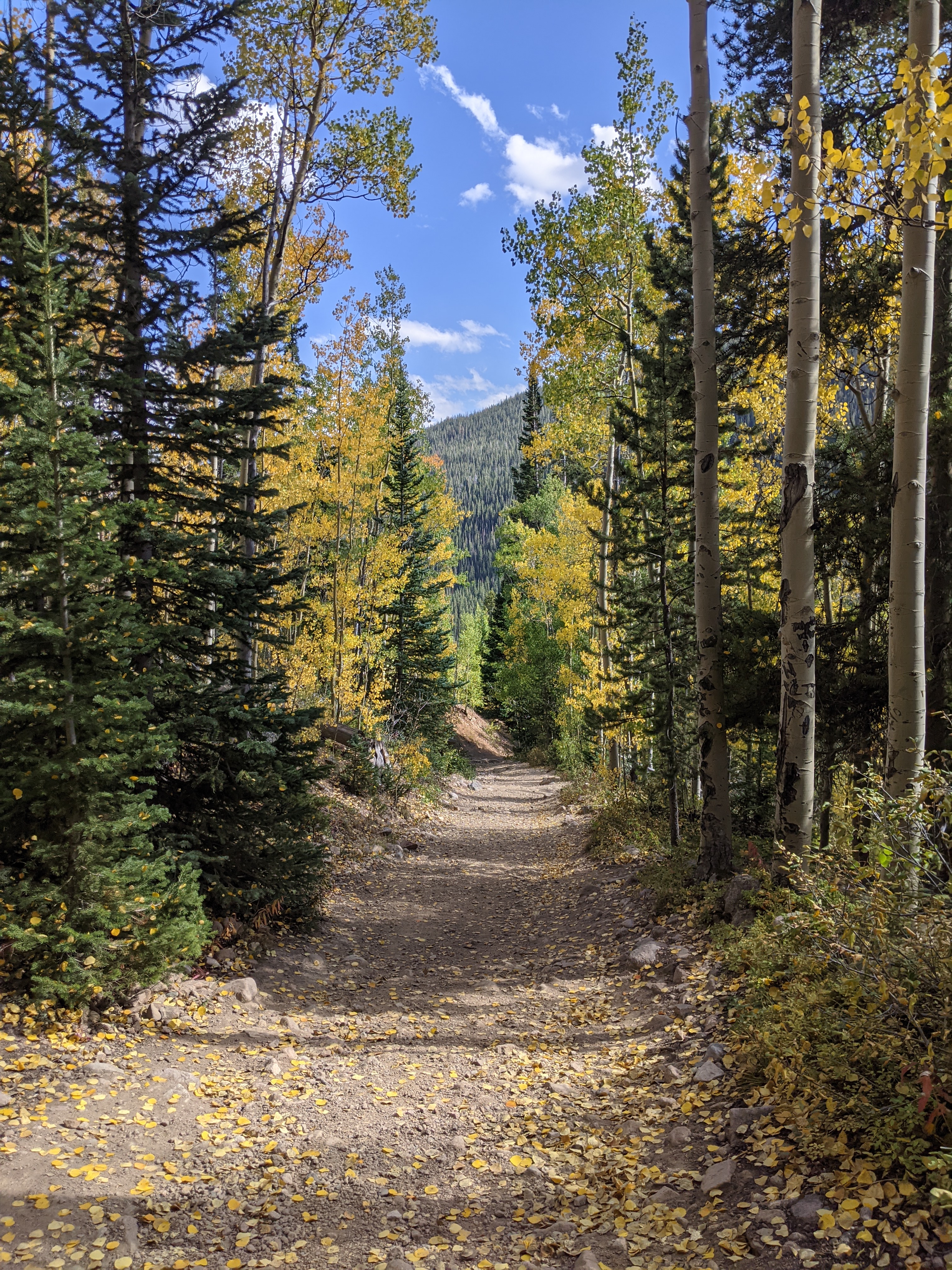
It was a beautiful ridge, too beautiful to be ruined by the cold wind we fought the entire time we were up there. As we left the final peak and began our descent into the valley and towards the trailhead, we got our first real look at fall in Colorado. We had been at such high elevation for so long that we hadn’t really noticed the changing season. Back in the Tetons we had started seeing our first signs of fall above 10,000 feet. We’d felt like we were following that early change since then, but the final several miles before the road were the first time we felt like we were truly in a different season seeing how many Aspens were turning yellow.